Coastal Flood Risk
Coastal flooding typically occurs during seasonal high tides and storms. As sea level rises, floods are expected to happen more frequently and during less extreme events. Low-lying coastal areas are most susceptible to these changes, and no datasets are publicly available that demonstrate comprehensive coastal flood risk with:
Sufficient spatial resolution to effectively represent property scale risk and damage.
Information about inundation depth and frequency of flooding.
Future inundation projections from the combined effects of storm surge and sea level rise.
Introducing a solution to this critical problem, the UrbanFootprint Coastal Flood Risk Model uniquely estimates both present and future coastal flood risk for the contiguous United States (CONUS). This dataset accounts for the variability inherent in environmental factors, and the future scenario is calibrated to account for sea level rise adjustments. Our model calculates the exposure risk of parcels and community attributes to comprehensive flood inundation depths for present and future return periods.
Our model combines these three datasets:
NOAA National Storm Surge Risk – provides the Maximum Envelope of Water (MEOW) depths or worst snapshot of the basin for Saffir-Simpson Category 1-5.
UrbanFootprint Tropical Cyclone Wind Risk Model – provides wind speed exceedance probabilities aligned with the Saffir-Simpson categories.
NOAA Sea Level Rise Technical Report – used to provide parcel Base-Canvas property level scale for comprehensive coastal flood risk.
We combine storm surge inundation depth data and tropical cyclone wind speed probability of exceedance data to jointly assess their impact on surge probabilities. In this context, we assume that the surge depth for a given category (Saffir-Simpson Category 1-5) results from the induced surge from the corresponding tropical cyclone category. Therefore, we assume that the surge exceedance probabilities equal the tropical cyclone exceedance probabilities at the location, which accounts for differences in topography, location, and timing of the hurricane and surge.
We calculate surge depths for surge probabilities for 100-year, 300-year, and 1000-year surge exceedance for the historical period from 1980-2017 and a future scenario for 2015-2050 based on Tropical Cyclone Winds. The future scenario coastal flood depths are climate-adjusted to account for rising sea levels that can have compounding effects on storm surges.
This model estimates the frequency and severity of coastal flooding for surge events with annual chances of 1%, 0.3%, and 0.1%. For example, we found that 300,000 more people and 47 million more in property value will be at risk of inundation in the next 30 years than are today.
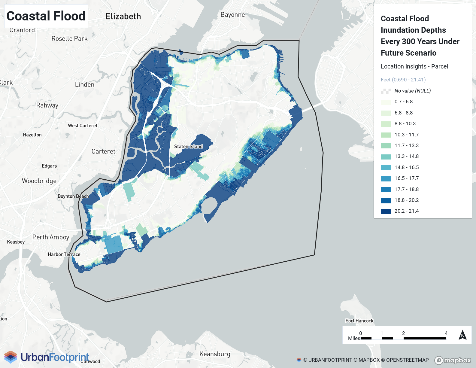
Analyst Example - Coastal Flood shows the coastal flooding impact on Staten Island, NY parcels from the Location Insights parcel layer in Analyst.
 |
Availability: Location Insights | Climate & Hazard Insights