Map and Data Exports FAQs
Frequently asked questions about mapping and exports.
- Can I export a map as a PDF?
- Can I edit layer names in a map legend?
- What map projection does Analyst use?
- What font does Analyst use for map titles and legends?
- Where are the map export and snapshot buttons?
Can I export a map as a PDF? | ||
Analyst exports maps to PNG and SVG formats. While PDF exports are not available, SVG exports may serve your needs. SVG exports are vector image files can be opened and edited using Adobe Illustrator or other vector graphics editing programs. From Illustrator, you can save to PDF. An SVG map export includes all map layers, symbolized and at the same extent as they appear in the map export view. The option to export a map to SVG is available through the Map Export feature. See the Export a Map to SVG article more information. A PNG map export is a raster image that includes map layout elements (legend, title, logo, scale bar, and north arrow). See Export a Map to PNG for more information. Single layers can also be exported in their entirety as SVG files. For more information about exporting individual layers to SVG, see Export Layer Data. | ||
Can I edit layer names in a map legend? | ||
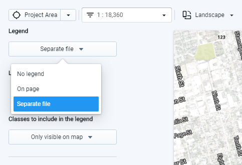
At this time, you cannot edit the layer names. For more control over legend labeling and formatting, you can export your legend as a separate file using the option in the map export window. You can then create a final version of your map in a graphics editing program, using elements from the legend image file (such as the color swatches) and creating labels manually.
Option to export map as a separate file | ||
What map projection does Analyst use? | ||
The Analyst user interface and map exports use the Web Mercator projection. All spatial data exports use the WGS84 geographic coordinate system. | ||
What font does Analyst use for map titles and legends? | ||
PNG map exports use the Roboto font for titles and legends. If you'd like to use a different font, consider exporting your map to PNG format without a title, and with a legend as a separate file. Then, you can layer on a title and legend labels using a graphics editing program. You can do the same with maps exported to SVG format. The Roboto font is available for free. You can download it here: https://fonts.google.com/specimen/Roboto. | ||
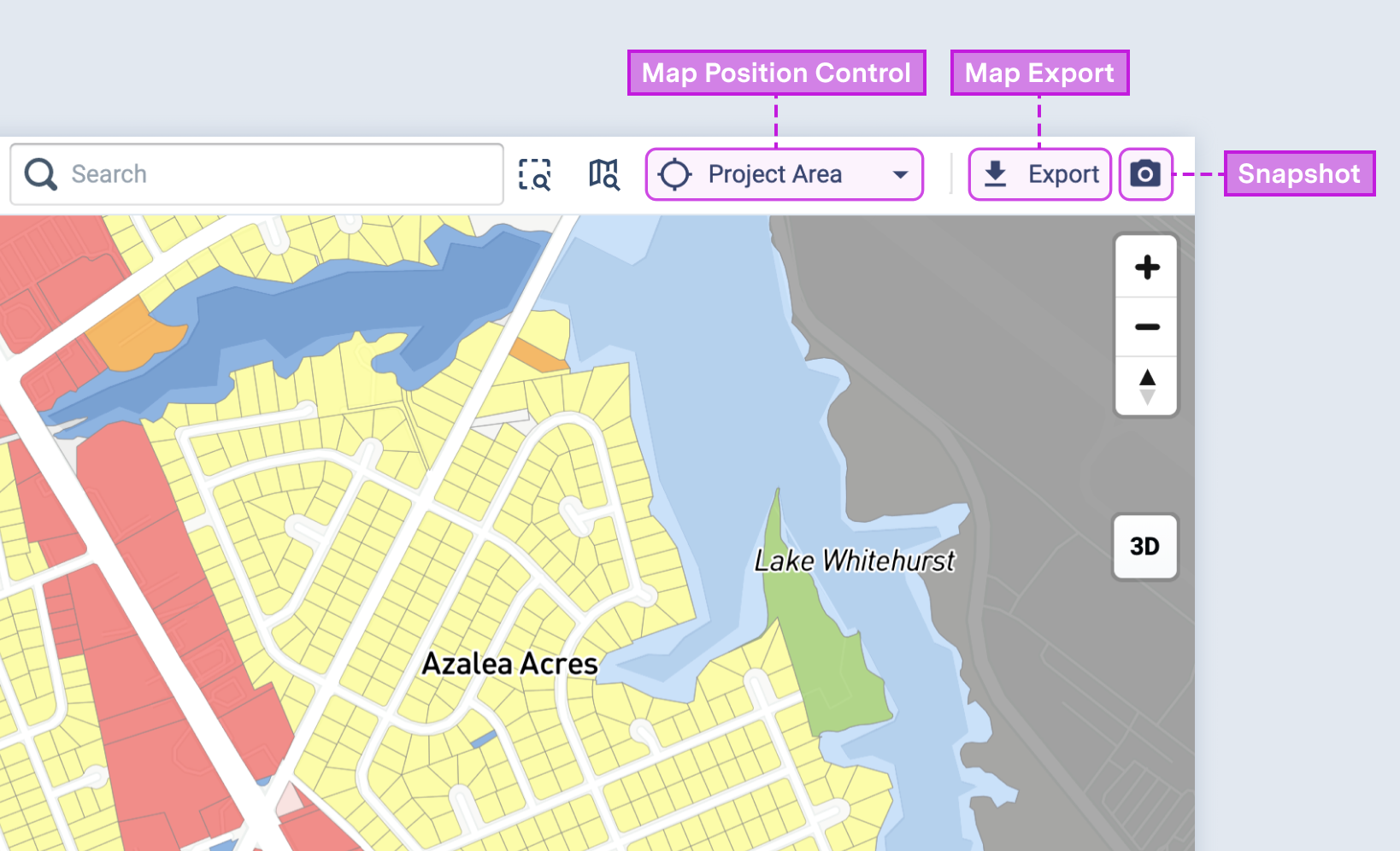
Where are the map export and snapshot buttons? | ||
The map export and snapshot buttons are located at the top right corner of the map pane, as shown below. However, the buttons may not appear on smaller screens (or in smaller browser windows) when the Layer Details pane is expanded. To access the buttons, try collapsing the Layer Details pane and/or reducing the zoom level of your browser's display.
|