Land Use Hierarchy
Analyst represents land use according to a classification system composed of four levels, offering users the flexibility to depict development at various degrees of detail. The hierarchy of categories ranges from a very high-level summary level down to specific Building Types and Place Types. Each feature in the base and scenario canvases is categorized according to all levels. The values for higher-level categories are automatically generated for the base canvas, and designated as part of the scenario painting process, via the Building and Place Type designations.
While the base canvas and scenarios must be defined in terms of Building and Place Types, they can be visualized or otherwise used to summarize information at any of the higher levels. The various levels are suitable for different applications; for example, regional plans may be best depicted using L1 categories, while corridor plans may be shown using Building Types (the L4 level).
Hierarchy of Land Use Level Categories
The hierarchy of categories is outlined in the table below. The categories are nested such that each lower-level category is associated with one higher-level category.
Land Use Level | Description | Example |
|---|---|---|
Land Use Summary (L1) | The highest-level category, suitable for broad classification. Level 1 (L1) categories include Residential, Commercial, Mixed Use, Industrial/Warehouse, Civic/Institutional, Transportation/Utilities, Vacant/Other, Open Space, Agriculture, Natural Resources, Natural/Conservation, and Water. Suitable for mapping at the regional, county, or city scales. | Residential |
Land Use Summary (L2) | A summary category that further differentiates between residential, commercial, civic/institutional, and open space uses. Other categories are shared with the L1 classifications. Suitable for mapping at the city or neighborhood scales. | Single-family |
Land Use Category (L3) | A category that further specifies use as would typically be indicated by local land use codes. Suitable for mapping at the neighborhood scale and smaller. | Single-family detached |
Land Use Type (L4) | Comprised of Analyst's building types and place types. Land use types indicate use as well as built form characteristics. Suitable for mapping at the neighborhood, corridor, and project scales. | Small lot single-family detached |
Land Use Level Classifications
The L1, L2, and L3 classifications are summarized in the following table. The L4 Building and Place Type classifications are too numerous to show, but they follow the pattern of nesting into the higher-level categories on a one-to-one basis.
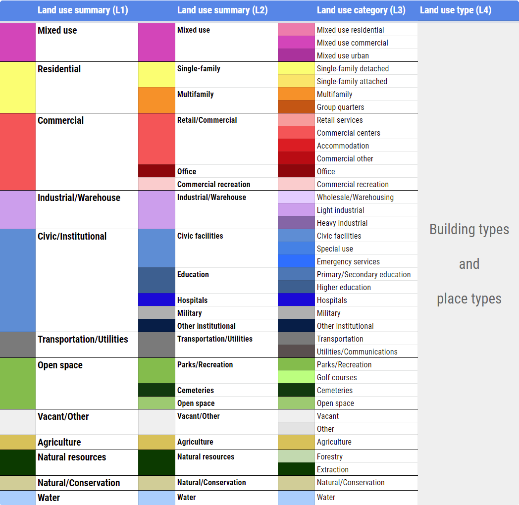 |
Schema of L1, L2, and L3 levels
Land Use Mapping
The ability to represent development at various levels of detail is valuable for producing effective maps and summarizing land use information. The default symbology for the land use classifications reflect a commonly used palette; like all symbology, the colors can be edited.
The following maps show the same area depicted according to the four land use category levels.
Level 1
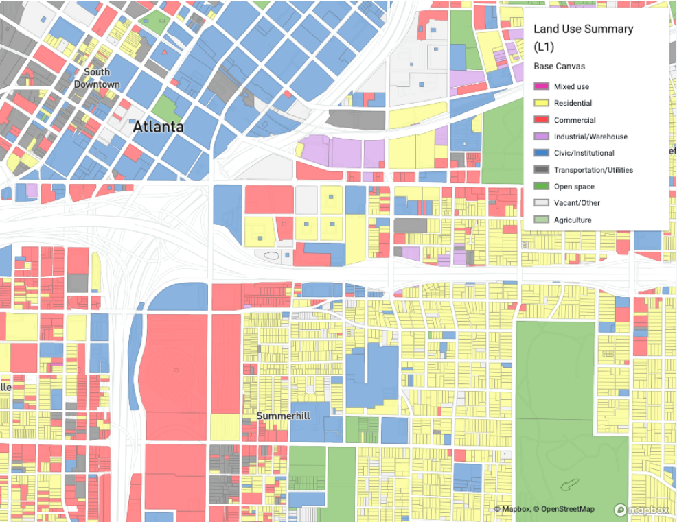 |
Level 2
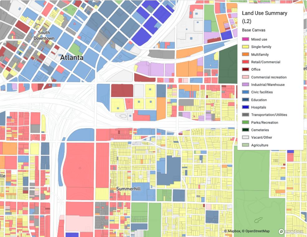 |
Level 3
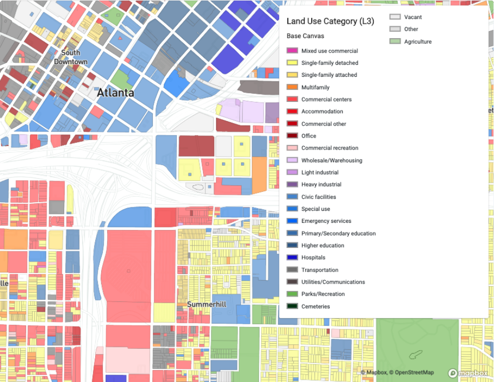 |
Level 4
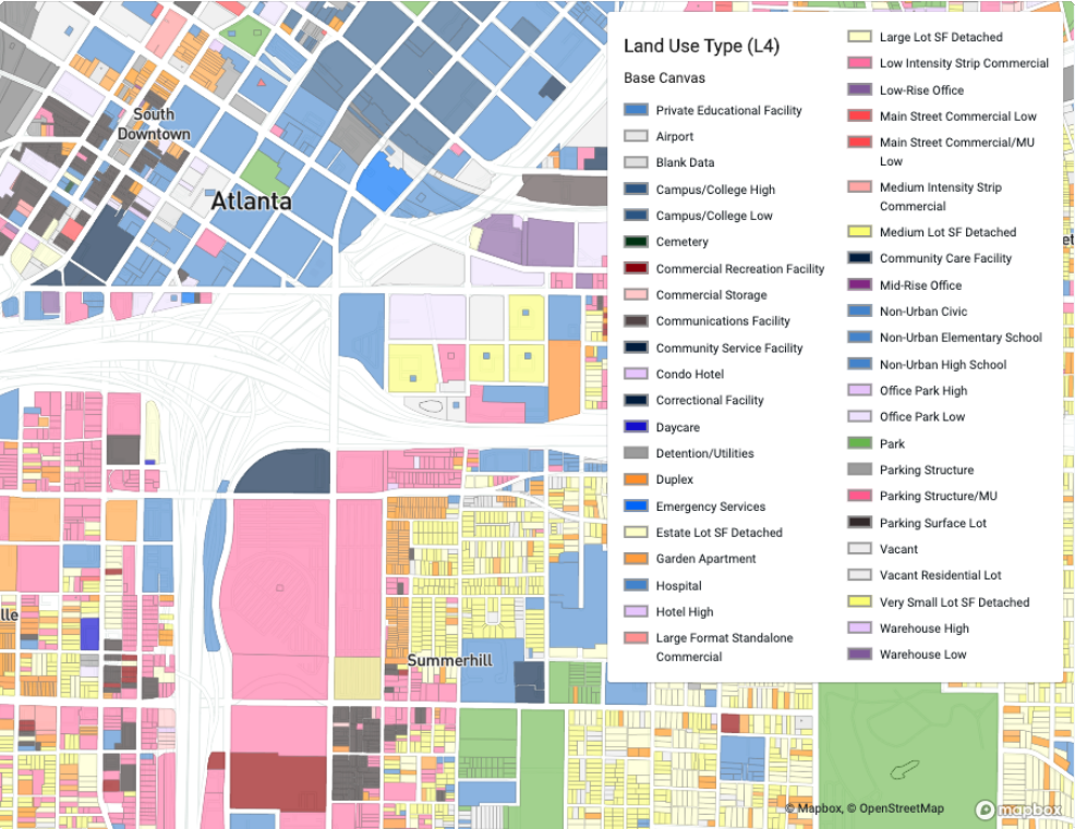 |