Create Point-on-Surface Layers
You are able to convert a polygon layer to a point layer with one click using Layer Details.
This is useful for removing excess geometries from a normal Join result. It's also a great way to speed up results in your Joins by simplifying the intersection workflow. This is also valuable in creating points of specific Land Use Types or column unit densities to combine into more dynamically styled maps.
For example: converting any Base Canvas Geometry will create a point at the center of the original geometry. The same goes for Reference layers where converting a single Census Block or ZCTA will create a point at the center of the Block or Zip.
Note
The resulting point layer will always retain all data from the original layer.
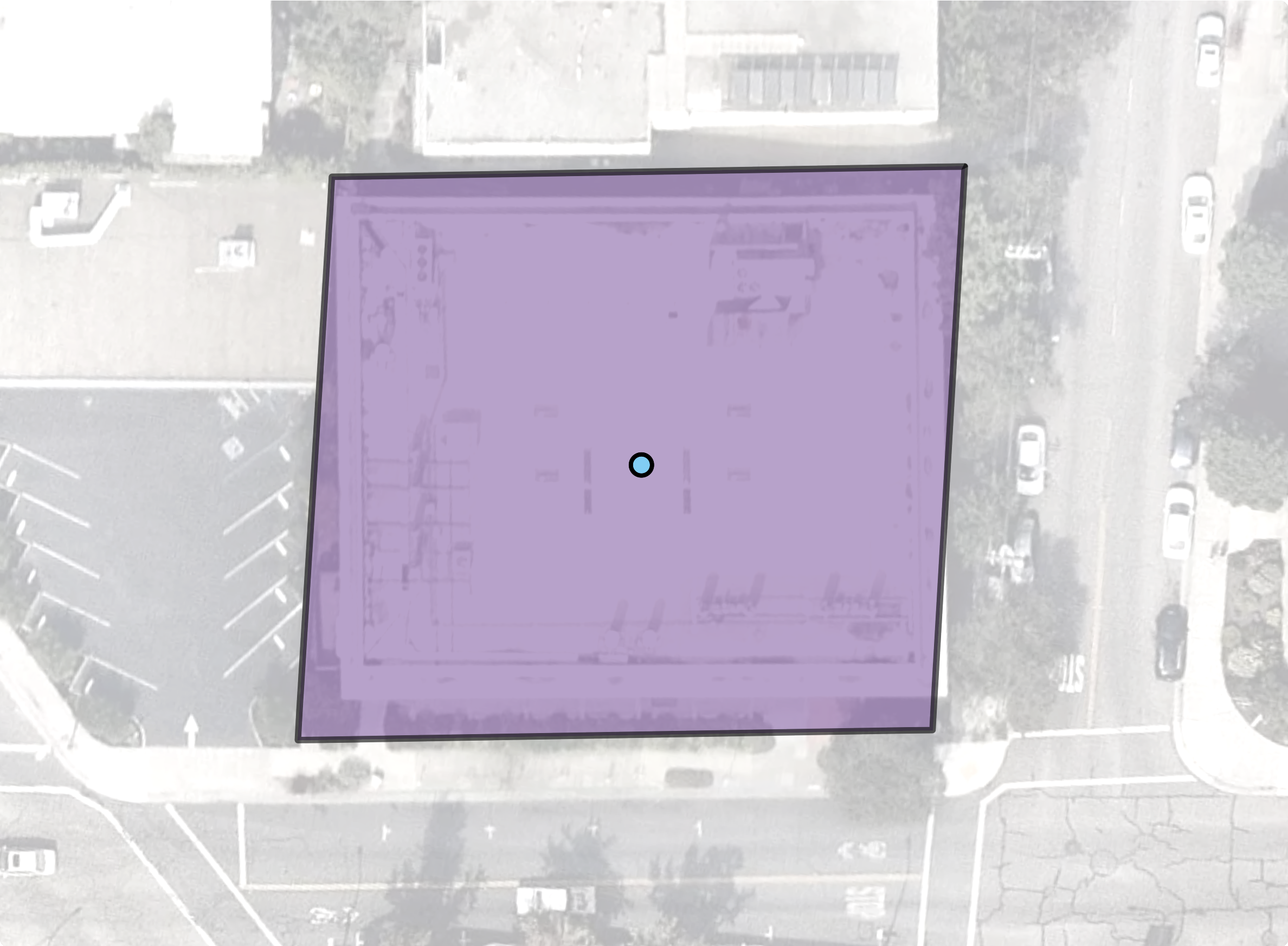 |
A Single Parcel shape with the Point-On-Surface for it at the center
Walkthrough
Scroll over to the layer you want to convert in your Layers list.
Select the Open menu
 button to open the Layer options menu.
Select the Convert to point layer option.
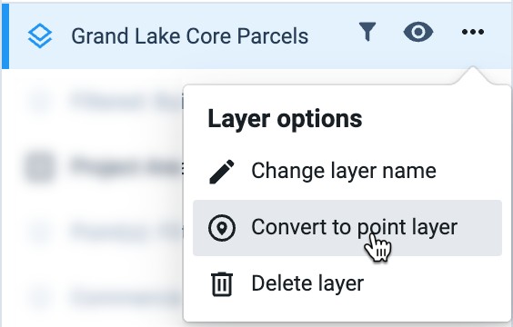
Provide a name for the new layer. By default, the name will be prefaced with "Point(s):" and the original layer name.
Select Ok.
Once converted, the layer will appear in your Layers list.
Select the layer to make it active in your project and view.
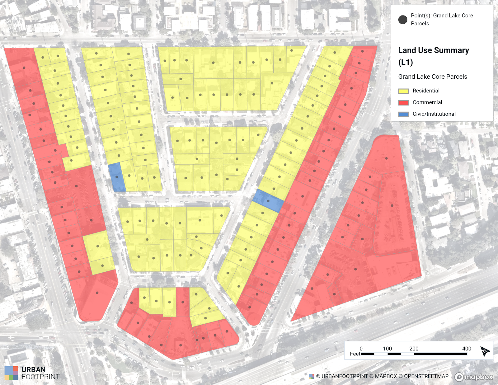 |
Parcels Converted to Points
Other Examples:
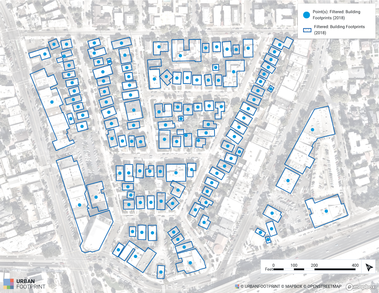 |
Building Footprints Layer Converted to Points
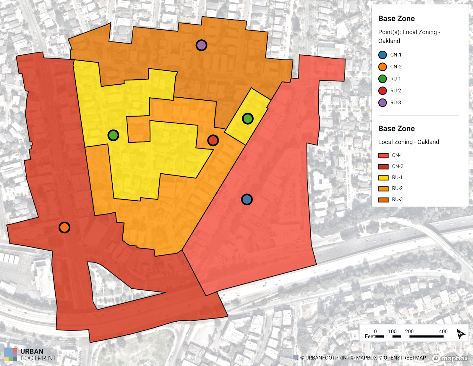 |
Local City's Zoning Shapes converted to Points