Existing Conditions Dashboard
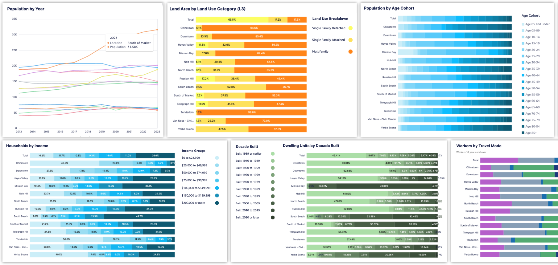 |
Assessments of existing conditions are part of almost every urban planning, design, and real estate project. They are fundamental for understanding context and informing planning and policy development. The Existing Conditions Dashboard provides quick assessments of land use and community, employment, and transportation characteristics for areas of your choice – custom project areas, neighborhoods, cities, towns, counties, and more. Once you designate the areas you want to assess, UrbanFootprint automatically gathers data and creates a full suite of charts and tables ready for reporting that sets the stage for deeper geospatial analysis. A dashboard can be created for any number of neighborhoods, districts, or subareas.
The Existing Conditions Dashboard uses data from the UrbanFootprint Base Canvas and the American Community Survey (ACS) – core data already integrated into the UrbanFootprint platform. This yields a consistent set of metrics in any location, and ensures that the data are compatible with other analyses using Base Canvas parcel data or the ACS metrics contained in the Community Insights data layers.
Existing Conditions Dashboards are created and accessed via UrbanFootprint Analyst, and are available to anyone with a user account.