Tornado Winds
A tornado is a narrow, violently rotating column of air extending from a thunderstorm to the ground, visible as a funnel of water droplets, dust, and debris. Tornadoes have wind speeds ranging from 65 mph (EF0) to over 200 mph (EF5) and can cause widespread destruction within minutes, often with little warning. The unpredictability of tornado paths and the localized nature of their impact make them particularly difficult to model and anticipate, leading to significant challenges in emergency response and disaster preparedness.
Understanding tornado hazards at a national scale enables you to anticipate and mitigate potential threats to the built environment and community. Proactive risk management based on accurate hazard probability estimates safeguards physical assets and ensures sustainable development in the face of evolving environmental challenges.
UrbanFootprint Tornado Winds enables you to assess the probability of localized tornado wind risk across the United States for all tornado magnitudes on the Enhanced Fujita (EF) scale on an H3 zoom level 4 grid.
Example Maps in Analyst
This pair of images showcases how you can visualize tornado winds in Analyst. In these examples, exposure to tornado winds of EF0 or stronger is shown for the contiguous United States (CONUS) and the southeastern United States.
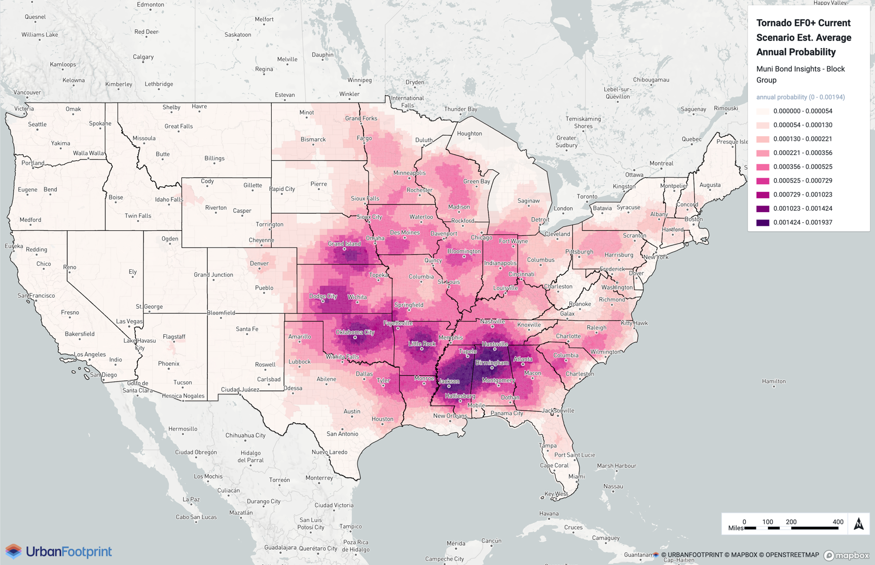
Current scenario (CONUS)
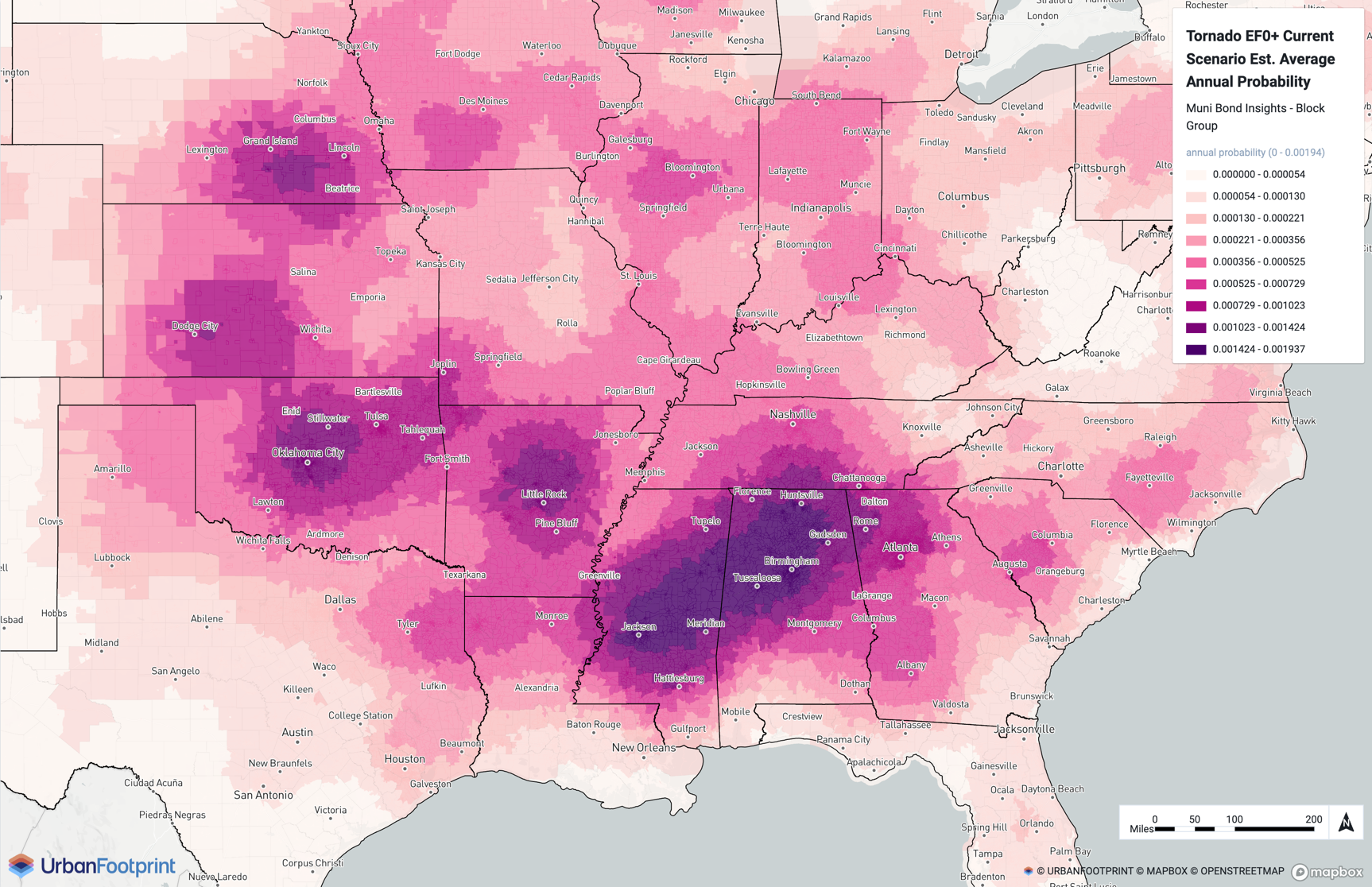
Current scenario (southeastern U.S.)
Details
We use historical tornado occurrences from the National Oceanic and Atmospheric Administration (NOAA) Storm Events Database to estimate probabilities of exceedance for a given tornado magnitude. The probability of exceedance can be estimated as the ratio of the tornado impact area and the total location area divided by the number of years on the historical record. We apply area corrections to account for the wind speeds decreasing as you move farther away from the center (Standohar-Alfano & van de Lindt (2014)). Finally, we use a Bayesian correction to estimate probabilities of high-intensity, low-probability events.
This model can be used to estimate the probability that a parcel will be impacted by a tornado in a single year.