
Resilience Insights

Supported Geographies

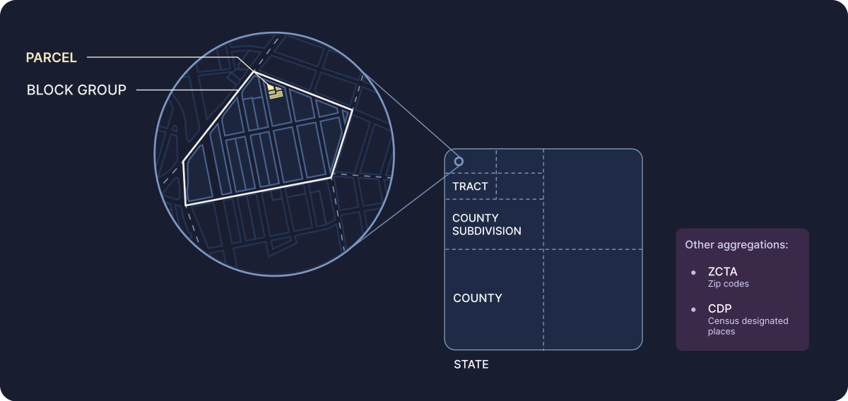
We offer a range of aggregation levels so you can choose which granularity is most relevant to the use case at hand. We support some datasets at the parcel level, and others span from the block group to the county, as shown in Supported Aggregation Geographies.

Figure 1. Supported Aggregation Geographies
Supported Aggregation Geographies


As you create your projects, keep in mind that each insight package supports a specific set of aggregation geographies:

  • Location Insights – parcel, block group, tract, ZCTA, place, and county.

  • Climate & Hazard Insights – parcel, block group, tract, ZCTA, place, and county.

  • Community Insights – block group, tract, ZCTA, place, county subdivision, county, school districts (unified, secondary, and elementary), congressional districts, and state legislative districts (upper and lower).

  • Energy Program Insights (if applicable) – block group, tract, and ZCTA.

  • Grid Resilience Insights (if applicable) – block group.

Each supported geography also appears as a separate layer in Analyst (see Resilience Insights Layers).

Figure 2. Resilience Insights Layers
Resilience Insights Layers