Project Overviews
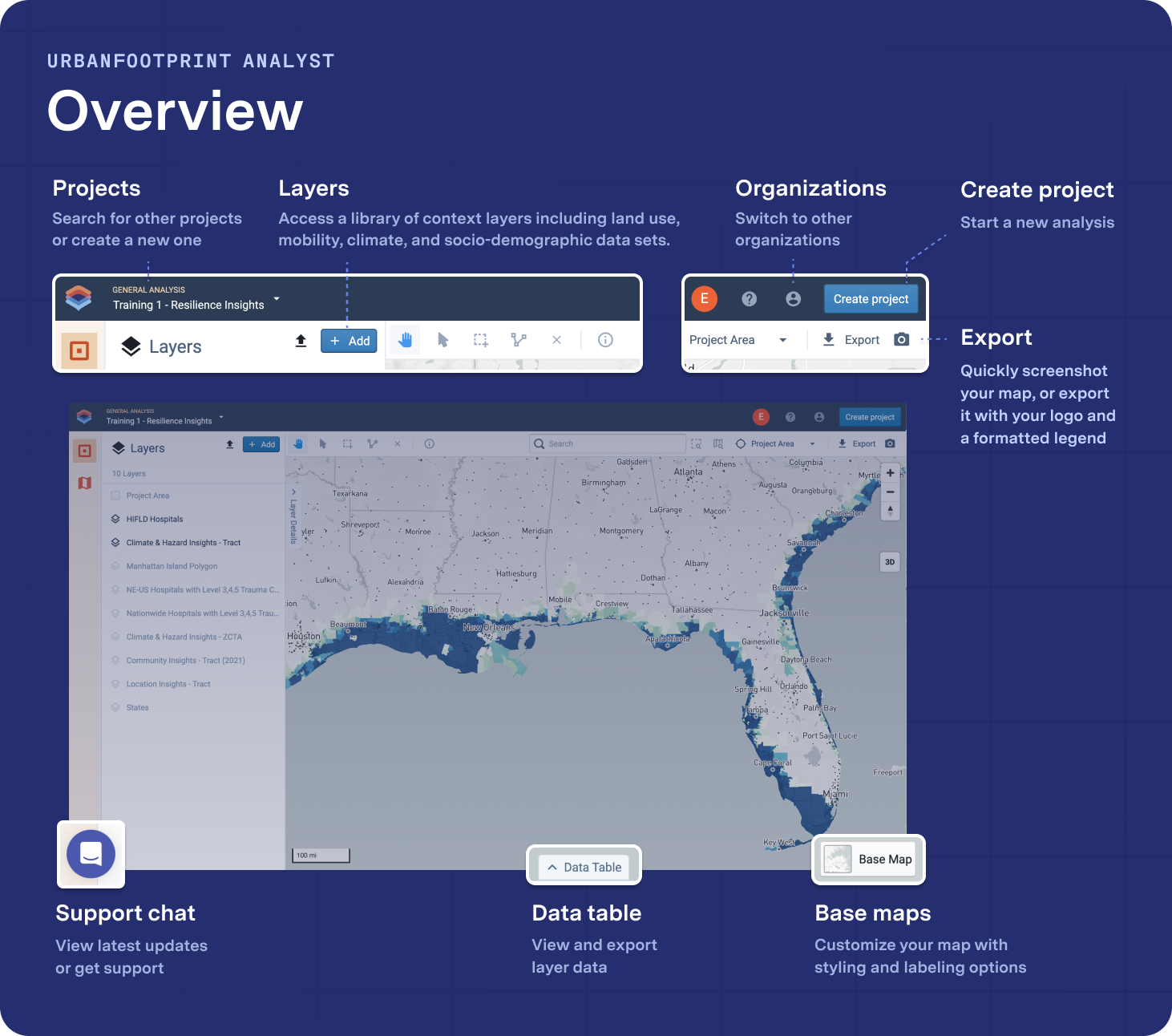
General Location Analysis Project
Use General Location Analysis projects to create a national or regional-scale project with access to core reference data and geospatial tools. With this type of project, you don't have access to parcel-based Insight Layers or Base Canvas. See Create a Project to get started.
Figure 1. General Location Analysis Project
 |
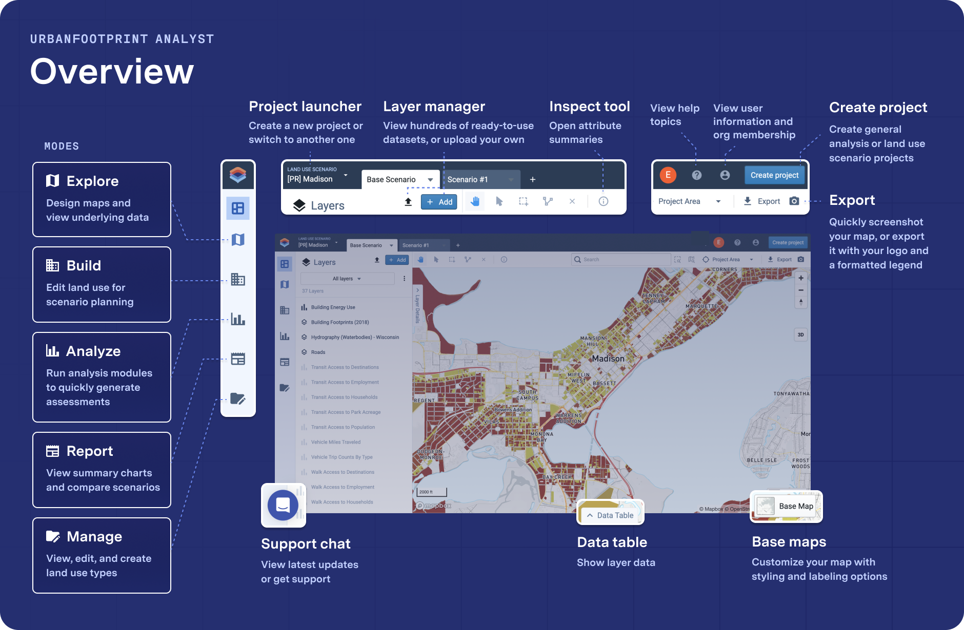
Land Use Planning Project
With Land Use Planning projects, you can create parcel-level projects using the Base Canvas with areas that intersect under 350 census tracts. You can also run and build scenarios and analysis modes with these projects. See Create a Project to get started.
Figure 1. Land Use Planning Project
 |